
Travel Guide
Where is the nile river?
14 min read
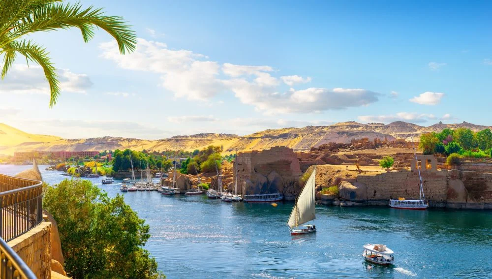
For millennia, humanity has stood in awe of a mighty blue ribbon that slices through the harshest deserts on Earth, seemingly defying nature as it relentlessly flows from south to north. It is a river that did not just sustain life; it gave birth to one of the greatest civilizations the world has ever known. If you look at a map and ask yourself, "where is the nile river?", you are not merely looking for a set of geographical coordinates. You are tracing the very cradle of human history.
This majestic waterway is not just a body of water; it is the geographical, cultural, and economic backbone of an entire continent. From the deep, mist-covered lakes of central Africa to the sun-drenched temples of Upper Egypt, the Nile has shaped the destiny of nations. In this comprehensive guide, we will embark on a journey along its legendary currents—uncovering its mysterious sources, exploring the ancient floods that inspired the pharaohs, and revealing why cruising its waters remains a premier global travel experience in 2026.
How long is the nile river?
To fully answer the question of exactly where this legendary waterway is located, we must look far beyond the borders of Egypt. The Nile is an African titan, located in the northeastern quadrant of the continent. It boasts a staggering length of approximately 4,135 to 4,258 miles (6,650 to 6,853 kilometers), pouring an average discharge of 2,830 cubic meters of water per second into the Mediterranean Sea.
For decades, there has been an ongoing scientific debate regarding its status as the absolute longest river on Earth. While some researchers argue that South America's Amazon River might hold the title depending on how its intricate estuary is measured, the Nile undeniably remains a geographical marvel of unparalleled length and historical impact.
Far from belonging to a single nation, the Nile's massive drainage basin covers about 10% of the entire African continent. It weaves its way north through a diverse tapestry of 11 different countries: Burundi, Rwanda, Tanzania, Kenya, the Democratic Republic of Congo, Uganda, Ethiopia, Eritrea, South Sudan, Sudan, and finally, Egypt.
To understand its complex anatomy, geographers divide the Nile watershed into several distinct segments from its source to its mouth:
The Sources of the Nile: The river’s humble beginnings are often traced to the Kagera River, which flows through Burundi and Rwanda. This network of streams eventually feeds into the massive Lake Victoria near Jinja, Uganda.
The White Nile: Emerging from Lake Victoria, this massive tributary stretches for about 3,150 kilometers. It earns its name from the light, clay-rich sediment it carries as it meanders northwards through Uganda and South Sudan.
The Blue Nile: While the White Nile is the longest tributary, the Blue Nile provides the vast majority of the river's water and fertile silt (about 80%). It originates from the high-altitude waters of Lake Tana in the Ethiopian Highlands, stretching roughly 1,600 kilometers.
The Middle Nile: The White and Blue Niles finally embrace at a spectacular confluence in Khartoum, Sudan. From here, the unified river—known as the Middle Nile—powers through arid desert terrain, cascading over a succession of six historic cataracts (shallow, rocky rapids) before crossing the Egyptian border.
The Lower Nile: This is the iconic final chapter of the river's journey. Spanning the last 1,500 kilometers entirely within Egyptian territory, it flows from the southern border at Aswan all the way to the Mediterranean coastline.
Where is the nile river?
When exploring the final 1,500 kilometers of the river's journey, we encounter a dramatic geographical divide. Within Egypt, the waterway carves the nation into two distinctly different regions, each boasting its own unique landscape and historical identity.
- Upper Egypt (The Nile Valley): Despite its name, Upper Egypt is actually located in the southern portion of the country, stretching from the Sudanese border at Lake Nasser all the way north to the capital city of Cairo.
This region is characterized by a narrow, ribbon-like fertile plain that rarely exceeds 20 kilometers in width. It serves as a stunning corridor of green life, sharply bordered by the harsh, extreme aridity of the Eastern (Arabian) and Western (Libyan) Deserts. It was along this constrained lifeline that the ancient pharaohs constructed their most awe-inspiring monuments, tightly hugging the river's life-giving banks.
- Lower Egypt (The Nile Delta): As the river flows past Cairo, it breaks free from its narrow valley and bursts open into a vast, fan-shaped estuary known as Lower Egypt. To the ancient Greeks, this expansive, flat region resembled an inverted triangle, prompting them to name it the "Delta." Historically, the river fanned out into seven distinct branches before reaching the Mediterranean Sea.
However, over centuries of shifting sands and human intervention, it has narrowed down to two main arteries: the Rosetta branch in the west and the Damietta branch in the east. Today, this lush, incredibly fertile delta is the agricultural powerhouse of Egypt, serving as home to roughly 40% of the nation's entire population.
The Key to Ancient Egyptian Civilization
The mere presence of water in a desert landscape is not what allowed one of history’s greatest civilizations to thrive. The true magic of this ancient waterway lay in its rhythm and its power—specifically, the annual flooding phenomenon. Without this yearly miracle, the majestic temples, towering pyramids, and complex society of antiquity would simply never have existed.
The scientific mechanism behind these floods originates thousands of miles away from the Egyptian borders. Between May and August, intense summer monsoon rains hammer the distant Ethiopian Highlands. This massive, sudden influx of water dramatically swells the Blue Nile and the Sobat River, sending a colossal surge of freshwater and thick, nutrient-rich silt rushing northwards toward the Egyptian desert.
For the ancient Egyptians, this annual inundation was so fundamental to their survival that they organized their entire society and calendar around it, dividing the year into a strict three-season agricultural cycle:
Akhet (The Flood Season): Running from July to November, the river would dramatically overflow its banks, transforming the valley into a shallow lake and depositing a fresh layer of black, fertile silt across the land.
Peret (The Emergence Season): From November to March, the floodwaters would gradually recede. This was the crucial time for plowing the newly fertilized earth and sowing seeds. Wheat was one of the first and most vital crops cultivated, acting as the primary food source for the kingdom.
Shemu (The Harvest Season): Between March and July, the crops were gathered and stored, sustaining the population through the dry, blistering summer months until the cycle inevitably repeated.
To survive and thrive, the ancients had to anticipate the volume of the incoming waters. They developed an ingenious system of measurement using structures known as Nilometers. These descending stone staircases and pillars, many of which can still be visited in Aswan and Cairo today, tracked the exact water levels. The readings were vital for the kingdom's administration; an optimal flood of up to 14 meters in Aswan would translate to a manageable 7.5-meter rise downstream in Cairo. Too little water meant devastating famine, while too much spelled catastrophic destruction for the mud-brick villages.
The Aswan High Dam & Lake Nasser
For millennia, the river’s unpredictable rhythm dictated the fate of the Egyptian people. However, in the mid-20th century, the landscape of the country was forever altered by a colossal engineering feat: the construction of the Aswan High Dam. Spearheaded by President Gamal Abdel Nasser, this mega-project was designed to tame the wild waters, bringing an abrupt end to the historic annual floods.
The primary benefits of the dam were immediate and transformative. It provided the nation with crucial flood control, eliminating the seasonal variations that once threatened to wash away villages or cause catastrophic droughts. Furthermore, the dam's massive turbines generated a steady supply of hydroelectricity, powering Egypt's modernization.
However, taming nature came with profound social and cultural impacts. The damming of the river created Lake Nasser, a massive artificial reservoir stretching approximately 550 kilometers long. The rising waters of this new lake forced the heartbreaking displacement of the southern Nubian communities, whose ancestral villages were swallowed by the reservoir.
The rising waters also threatened to erase some of the world’s most precious historical monuments. In an unprecedented show of global cooperation, UNESCO launched a massive international rescue mission. Iconic structures like the grand temples of Abu Simbel and the beautiful Philae Temple were painstakingly dismantled block by block and reassembled on higher ground. As a gesture of immense gratitude to the nations that assisted in this monumental effort, the Egyptian government gifted several ancient temples to global collaborators, the most famous being the Temple of Debod, which now stands in a serene park in Madrid, Spain.
Cultural and Religious Significance: Myths and Creation
Because the ancient Egyptians lacked the scientific knowledge to explain the monsoon rains occurring thousands of miles away, they turned to the divine to understand their lifeline. The river's annual flood was steeped in rich mythology and religious reverence.
The God Hapi: The Egyptians personified the life-bringing floodwaters in the form of Hapi, a plump, fertile deity. They believed Hapi lived in a hidden cave near the river's treacherous southern waterfalls, emerging only once a year to release the sacred inundation.
The Tears of Isis: Another poignant myth attributed the rising waters to the deep sorrow of the goddess Isis. It was said that her sacred tears, shed while mourning the murder of her beloved husband and brother, Osiris, caused the river to swell and overflow its banks.
The river's cyclical nature of receding waters and emerging fertile land deeply influenced ancient Egyptian cosmogonies (creation myths). Whether in the theological centers of Heliopolis, Hermopolis, or Memphis, their worldview centered on the concept that all life spontaneously emerged from a dark, boundless expanse of primordial waters. It is no wonder that the ancient Greek historian Herodotus immortalized this deep connection with his famous quote: "Egypt is the gift of the Nile."
The Economic Engine: From Ancient Engineering to Modern GDP
The river has always been the ultimate economic driver of the region. In antiquity, the challenge of harnessing the floodwaters spurred incredible advancements in engineering. During the Middle Kingdom, complex irrigation networks and canals were developed to channel the water, most notably in the El Fayum oasis. Centuries later, these systems were continually refined, such as when the famous Muslim leader Saladin renewed the Bahr Yussef (Joseph’s Canal) in the 12th century.
Yet, this reliance also brought severe economic vulnerabilities.
Historical periods of political instability and devastating famine were often triggered by unpredictable flood variations. A notorious example is the era of the Fatimid caliph Al-Mustansir, where prolonged low water levels led to a crippling, years-long famine.
Today, while the Aswan High Dam has stabilized the water supply, the river remains indispensable. The rich agricultural crops cultivated along its banks still contribute over 10% of Egypt's entire GDP, while the waters support vital local fishing industries. Above all, the river has birthed a massive modern tourism infrastructure, serving as an irreplaceable economic engine through leisure excursions and world-class cruise lines.
Guide to Nile River Cruises & Activities
If you are planning to experience the magic of this waterway firsthand, navigating the various options is essential. Cruising remains one of the most rewarding ways to absorb the history and culture of the region.
Nile Activity Options
The Cairo Experience: If you are short on time, the capital offers delightful bite-sized experiences. You can enjoy short, breezy rides on a traditional felucca, dine at upscale floating restaurants, or visit lush agricultural sites along the urban riverbanks.
The Upper Egypt Experience: For the quintessential journey, multi-day cruise itineraries operate in the south, elegantly connecting the breathtaking historical sites between Luxor and Aswan.
Comparison of Vessel Types
Not all boats are created equal. You can choose an experience tailored to your travel style:
Nile Cruises: These are large, motor- or solar-powered floating hotels. They typically feature around 40 cabins, expansive sun decks, swimming pools, fitness centers, and modern amenities.
Dahabiyas: For a more intimate, boutique experience, these small, traditional wind-powered wooden boats are unparalleled. With only about 10 cabins, they offer exclusive, slow-paced travel reminiscent of early 19th-century explorers.
Feluccas: These are small, traditional sailboats relying entirely on the wind and river currents. They have no sleeping cabins and are best suited for scenic day trips or sunset sails.
Vessel Tiers and Luxury Options
Accommodations range from Standard and Deluxe to Luxury and Ultra Luxury. If you are seeking a premier 5-star experience, highly rated vessels include the Oberoi Zahra or Oberoi Philae (Super Luxury), the Sonesta St. George, the Steigenberger Minerva, and the Movenpick Royal Lotus or Royal Lily.
Cruise Logistics & Onboard Experience
Best Seasons: The peak travel window runs from November to February when the weather is perfectly crisp (average highs in the low 20s Celsius). The shoulder season falls between June and August, offering fewer crowds but requiring you to brave temperatures that frequently soar above 40 degrees Celsius.
Transit: The easiest and safest way to access your departure point is via domestic flights or sleeper trains from Cairo directly to Luxor or Aswan.
Entertainment: Cruises are vibrant cultural experiences. Expect a formal Captain's welcome cocktail party on the first night, traditional Galabia dress-up events featuring local music, and lively Nubian cultural performances.
Dining: Most packages are full-board, offering a mix of open buffets and set menus. You can also enjoy afternoon tea, coffee, and alcoholic beverages served directly on the sun deck as you watch the temples glide by.
Standard Timings: Much like standard hotels, expect an 11:00 AM check-in (just before lunch) and an 8:00 AM check-out (shortly after breakfast).
Dress Code: Comfort is key during daytime temple excursions—opt for light, breathable clothing. However, to respect local customs in a predominantly Muslim country, avoid overly short or tight attire when exploring towns. Onboard the ship, swimwear is perfectly acceptable on the sun decks, while "elegant casual" attire is the standard for evening dinners.
Budget Expectations: A trip down this historic river is surprisingly accessible. Average entry-level costs for a comprehensive 5-star cruise package generally start around $445 per person, scaling upward based on the vessel's luxury tier and the length of the journey.
Frequently Asked Questions
1. Where exactly is the Nile River located?
The river is located in the northeastern quadrant of the African continent. It is a massive north-flowing waterway that begins in the Great Lakes region of central Africa (with primary sources like Lake Victoria and Lake Tana) and winds its way through 11 different countries—including Uganda, Ethiopia, Sudan, and Egypt—before finally emptying into the Mediterranean Sea.
2. What is the best time of year to book a Nile River cruise?
The peak travel window for a comfortable and highly enjoyable cruise is between November and February. During these winter months, the Egyptian weather is beautifully crisp and mild, with daytime highs resting in the low 20s Celsius. This makes exploring outdoor historical sites and ancient temples much more pleasant compared to the intense, blazing heat of the summer shoulder season (June to August).
3. Are there still crocodiles in the Nile River?
Yes, the famous Nile crocodile still exists, but you will not find them casually swimming near the cruise ships in Cairo or Luxor. Following the construction of the Aswan High Dam in the 1970s, the crocodile populations were entirely restricted to the southern waters of Lake Nasser. Today, the river north of the dam is safe from these ancient predators, allowing for secure sailing and riverside activities.
Conclusion
When we ask the seemingly simple question of where is the nile river, the answer transcends mere geography. To locate this mighty waterway is to pinpoint the exact cradle of human civilization. From its misty, disputed origins in the heart of Africa to its grand, sweeping delta on the shores of the Mediterranean, the river is a timeless testament to nature's power and endurance.